On camping trips, I usually enjoy planning days out walking from the campsite. In most places, there will be a couple of footpaths or bridlepaths leading out into the unknown, whether just to the next village or pub or linking into networks to take me far further afield. Our Norfolk campsite is disappointing in this respect; there are footpaths here but they don’t seem to lead anywhere exciting. I scouted a few out on my cycling trip yesterday and most point outwards into hundreds of metres of empty field, and I take little joy in tramping across ploughed fields to meet a thin strip of woodland before exiting the other side into emptiness once again.
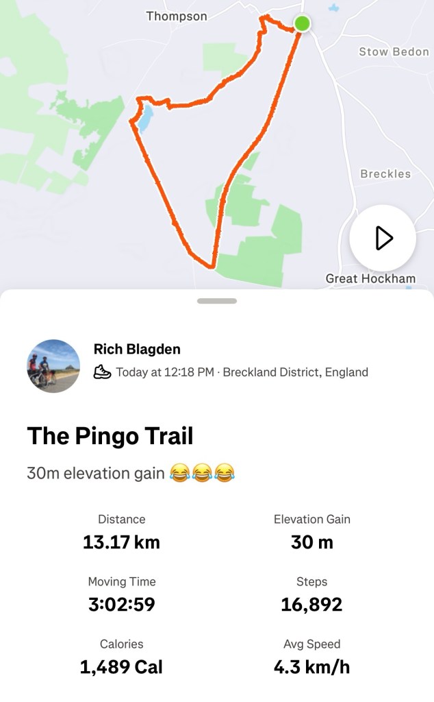
So I’ve been looking further away for walks. The coast, which offers great walking and some very beautiful locations, is over an hours drive away in almost all directions. We will spend a day on the coast walking, but today we were lucky to happen upon a great walking route quite close to Thetford: the Pingo Trail.
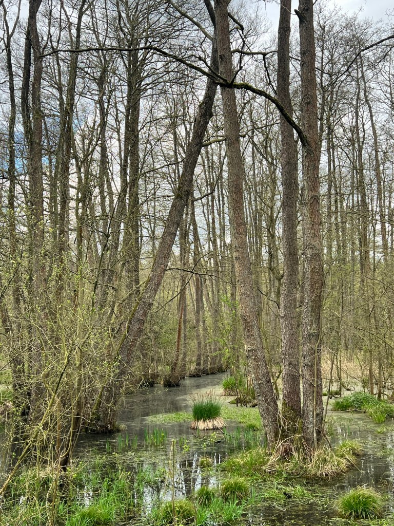
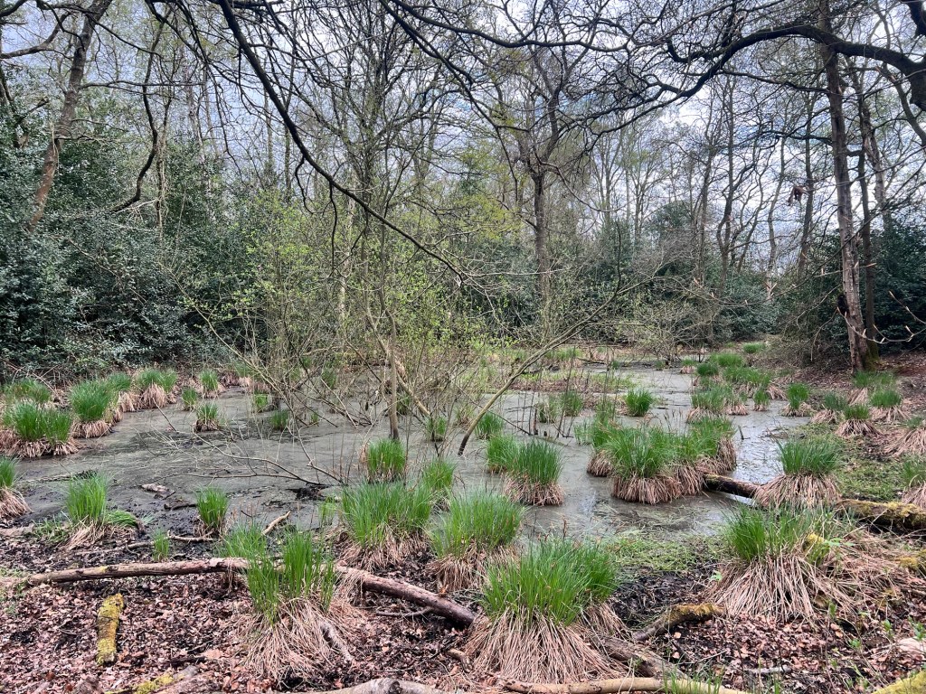
Pingos are, apparently, geographical relics formed in the last ice age – called kettle holes or kettles elsewhere. Glacial ice became trapped beneath the surface and when the ice melted depressions in the ground were formed. Norfolk used to be pock marked with these mini lakes, but agriculture has destroyed most of them. This walk, starting just south of the village of Watton, is a great way to investigate some of this unique habitat.

The walk begins at a small car park on the A1075 (grid ref TL940965). We started off walking on the disused railway line that leads SSW from Stow Bedon and almost immediately saw our first pingos. They are really like a series of unconnected ponds, fed purely by rainwater and they do give the impression of being packed full of life. Next to the old railway we quickly spotted several different species of butterflies. These sections of railway can sometimes be a bit boring to walk on, but here the bordering habitats were constantly changing and there was usually some sort of new wildlife to see or hear. We passed through the edge of Hockham Mere, once a huge lake but now a vast expanse of swamp. There were signs warning visitors that it probably wasn’t a good idea to stray from the path. We imagined what the mere would look like on a foggy day and agreed.
Soon we came to the end of the railway line and took a sharp right to meet up with the old Roman road, Peddars Way. It was lunchtime and we hoped by this point we would’ve found a picnic table or a bench, or at least a couple of strategically placed Logs to have something to eat. These never materialised so when our legs were ready to give out we simply flopped on a patch of grass next to the track and shared out our sandwiches. We reflected on how many pairs of boots must’ve passed along this road since it was built in the first century AD. After almost 2000 years, the road is still in good enough shape to be followed as a cycling route for most of it 74 km from Thetford to Holme-next-the-Sea.
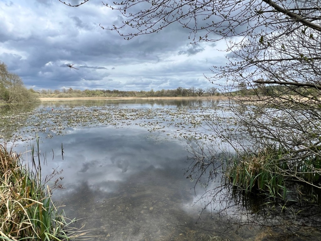
After a few more kilometres, we came to a little viewpoint that allowed us to look across Thompson Water and the path turned right to skirt the edge of this along a permissive path. The route zigzags through this attractive little woodland and we had plenty of fun identifying the different trees that we came across on the way. The real highlights, strangely, was towards the end when we passed a patch of open ground to our north which was designated as a conservation area. Almost by chance, we spotted Muntjac deer and hares before being briefly surprised by the incredible flight of a woodpigeon-sized bird. Its graceful flight was punctuated by sudden swoops and drops toward the ground, perhaps reminiscent of the flight of a hobby but this bird seemed too large. It was only when we heard the electronic calls, like a weirdly tuned ham radio, did I realise that we were watching the flight of a northern lapwing. If you haven’t seen or heard this bird before, please go to the RSPB website to check out its call – it really is a remarkable thing to hear.
Our final mission was to cross a section of ground that is apparently home to a herd of longhorn cattle. The idea of this frankly gave me the willies, but they didn’t seem to be any sign of them on site and we passed without incident. Phew.
Yesterday I was feeling a bit down on the Norfolk landscape. Lovely big skies and flat ground but I felt there wasn’t much potential for great walks. This trail was wonderful. there were lots of interesting small things to look at and occasionally we were treated to a viewpoint that revealed a bit more of the wider landscape. It isn’t the rolling hills and stunning coastlines that I’m used to in Devon, but today gave me a wonderful glimpse of a hidden side of rural Norfolk.